In medieval times, much of the land around Tysoe was farmed on a rotational basis in open fields, divided into strips and cultivated in the distinctive ridge and furrow patterns we see today. The ‘common’ was used for grazing with parishioners having rights to use it as such. A transcription of aerial photographs in the mid-20th century by Warwickshire County Council’s Historic Environment Record illustrates the extent to which Tysoe Parish was cultivated in the Middle Ages (Map 1). Many of these ridge and furrow lines can be seen to underlie later hedges and enclosures, but many have since been ploughed out in modern times.
Following the enclosure of land in the parish in the late 18th century, the landscape changed radically. Both the common land and the arable strips were ‘enclosed’ and smaller fields, usually surrounded by hedges, were established. It was an unpopular move at the time for a host of aesthetic, practical and political reasons for those who laboured in the countryside, but it remains largely the landscape that we see today. The imposition and effects of the enclosures in Tysoe are described in a contemporary account by Ashby (click here for suggested reading).

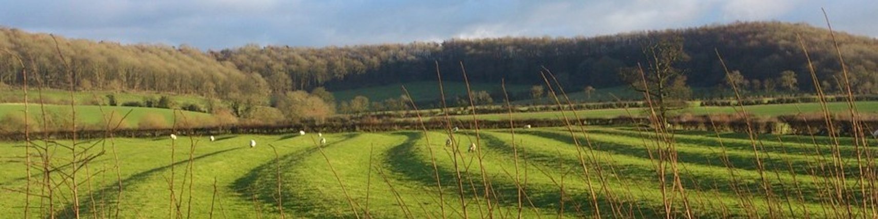
Field names have been used over the centuries by farmers to describe and identify individual parcels of land. They can tell us much about earlier landscape topography, history of settlement and land use. There are over 360 fields in the parish (Map 2) and THRG has collected names for most of them from several sources. These sources include estate maps, sales catalogues, deeds and other historical documents, research carried out in 1983 by interested residents, and the knowledge of several local farmers. Field names are dynamic and may change according to land use, crops grown, ownership or tenancy. Many fields have multiple names as a result. Their use was predominantly oral and this has resulted in a wide variety of spellings and variants on those occasions when the names were written down.

Although the majority of names derive from the late 18th century Inclosure Act due to the need to reference the newly created parcels of land enclosed by hedges, some older names have persisted from the open fields or from landscape features. Several have their origins over 1000 years ago and appear in sources from as early as the 12th century. Most were used informally and retained only in memory. THRG’s aim was to record them before they were forgotten.

Click here to view an alphabetical list of field names according to information currently available. Next to each name is a field number which can be located on Map 2. Because most fields have multiple names generated over time, click here to view a list of the fields in numerical order, showing the full list of names known for that particular field. Some fields have as many as five or six different names which reflect changes in ownership, subdivision, land use or local social factors.
In the alphabetical list efforts have been made to try and ascertain what these numerous names might mean, or their origins. Some are straightforward, but the interpretation of others can be speculative.
The oldest reference found so far is to the area around Hardwick Farm (fields 073 and 080), where the remains of a deserted medieval village lie nearby. The name ‘herdwic in parroch De Thiesho’ meaning ‘a farm for a herd of animals in Tysoe’ appears in a document dated c.1136. Fields with names ‘Coarse Mage’ and ‘Midge Furlong’ (field 176), ‘Coarse Midge’ (field 177) and ‘Corsmidge Hill’ (fields 167 and 168) all lead towards Compton Wynyates and possibly derive from ‘Cortesmershe’ found in a Northampton estate document dated 1353, although the exact meaning is unclear. ‘Wynnsway’ (field 330) and other clearly related spellings with the ‘wind-’ element may derive from ‘Wymmesway’ found in a document from the accounts of Henry VII (1485-1509) and pertain to windmills in those locations.
Field names such as ‘Shoulder of Mutton Slinket’ (field 240) may derive from the shape of the field, and some contain a personal name such as ‘Alwyn Styles Dairyground’ (field 126) or ‘Arthur Frosts’ (field 209). Distinctive topographical features have proved useful identifiers, such as ‘Ball Hill’ (field 285), ‘Ball Knob’ (fields 297 and 298) and ‘Ball End Furlong (field 359) all on Tysoe Hill, where ‘ball’ may indicate a rounded hill or hillock. ‘Quarry Ground’ and ‘Cow Pasture’ may not need much explanation, nor will ‘Dairy Ground’ which features no fewer than 26 times in the parish. By contrast ‘White Holes’ (field 285) requires local knowledge. This was a field containing old quarries which, during frosty periods, never thawed out during the daytime.

Tysoe also has many intriguing names which require further research. A group of fields west of Kineton Road and south of the A422 carry the name ‘New Zealand’, which may have been given in jest because of its remoteness from the farmstead, or it may have a connection with the emigration of Tysoe people to New Zealand in 1873. Interestingly, ‘The Promised Land’ (field 200 and others) is probably a tongue-in-cheek name for a group of fields given to villages as allotments by Lord Compton for their own use. The name reflects the many years of waiting, despite lobbying, between his initial agreement and handing them over in 1893.
Tysoe has its fair share of generic field name elements, such as ‘leys’ or ‘leaze’ (originally a piece of land used as temporary pasture between cultivation), ‘grounds’ (generally larger areas of pasture), ‘close’, ‘croft’ or ‘piece’ (small enclosures), ‘furlong’ (originally relating to open field agriculture and a measure of land for tenant cultivation), and ‘meadow’ (an open habitat mostly populated by grasses). Although many of these original names still survive several of the areas to which they once applied have since changed through subdivision.
This part of “The Making of Tysoe” project is very much a work in progress, and the THRG welcomes further information and comments on the work undertaken thus far. Field names can provide a wealth of knowledge about Tysoe, its agriculture and the people that worked the land. If you would like to add any further information to this intriguing snapshot of Tysoe’s earlier communities, help understand the field names or make comment, please email: thrg.info@gmail.com
Suggested further reading
Ashby, A.W. 1912. ‘One Hundred Years of Poor Law Administration in a Warwickshire Village’ reprinted in Vinogradoff, P. (ed.) 2005. Oxford Studies in Social and Legal History,Vol III, B2-190.
Ashby, M.K. 1961. Joseph Ashby of Tysoe 1859-1919. Cambridge University Press.
Beckinsale, R. and Beckinsale, M. 1980. The English Heartland. Duckworth.
Cameron, K. 1961. English Place Names. Batsford.
EPNS (= English Place-Name Society), 1970,Vol. 13 Warwickshire. Cambridge University Press.
Field, J. 1993. A History of English Field-Names, Longman
Gelling, M. 1978. Signposts to the Past, J M Dent and Sons.
Gelling, M and Cole, A. 2000. The Landscape of Place-Names, Shaun Tyas, Stamford.
Leith, D. 2005. A Border Walk in south-east Warwickshire. Privately printed.
Sale 1919 (= Sale brochure). The Tysoe Estate. Auctioneers Paxton and Holiday, Banbury.
VCH (= Victoria County History), 1949, Vol 5 Kington Hundred. Victoria County History, London.